
Site Discovery
for Gold Mining
Identify galamsey and mining sites with high-resolution satellite intelligence.
Protecting ecosystems across Ghana's mining regions, hear it from them:
“EcoHealth gave us the tools to track unauthorized galamsey operations and monitor mining sites in real-time. What used to take weeks of ground surveys now happens in hours.”
Angelo Asante
Founder & Lead Developer, EcoHealth
Made for Environmental Protection
Agencies enforcing environmental law.
Monitor vast mining regions for galamsey activity, receive automated alerts for new illegal operations, and deploy enforcement teams with precise GPS coordinates confidently.
Organizations monitoring environmental impact.
Detect unauthorized small-scale mining instantly, track environmental degradation over time, and protect rivers and forests with satellite intelligence.
How EcoHealth Works
From satellite to enforcement — a fully automated pipeline. ~90% accuracy and improving.
Satellite Capture
ESA's Sentinel-2 photographs Ghana every 5 days using 13 types of light including infrared invisible to the human eye at 10m per pixel resolution.
AI Detection
Our CNN, trained from scratch on thousands of real Ghanaian mining sites, spots exposed soil, cleared forest, and discolored rivers.
Live Map
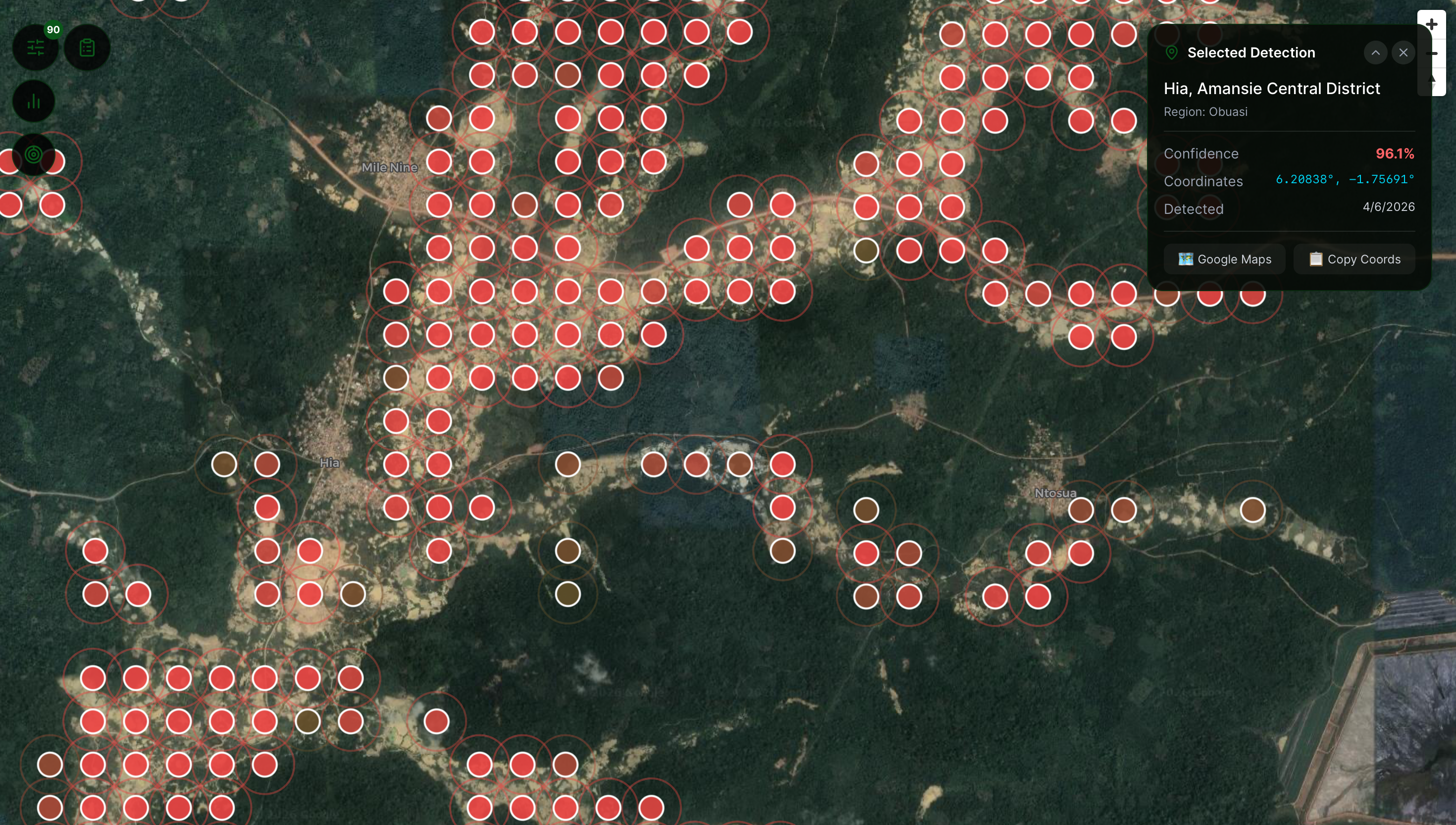
Every detection is pinned with GPS coordinates and a confidence score. Updates automatically every Monday or request a custom scan for any town in Ghana.
The pipeline, by the numbers
5,189
Sites detected
~90%
Model accuracy
5 days
Scan cycle
Discover Faster. Monitor Confidently.
A Visual Explorer for Mining Sites. Explore, analyze and flag galamsey operations with intuitive multi-layer viewing and real-time satellite imagery.
We're building the EcoHealth Hub — a centralized dashboard with drone footage, custom detection requests, evidence review, and team collaboration. Currently in active development.
Active Sites3 results
Ending the raid-and-return cycle.
For years the fight against galamsey has been reactive task forces arrive after the rivers have already turned brown, sweep a site, and leave. Within months the miners are back. EcoHealth exists to flip that timeline: detect sites the week they appear, verify them with drones, and keep enforcement in place long enough that they never reopen.
Help keep the satellites watching.
EcoHealth is independent and free for communities, journalists, and agencies. Your support funds compute for weekly scans, model retraining, and the V2 drone-verification program.
Payments are processed securely by Moolre. Mobile money supported across all networks in Ghana.